Hurricane Helene is Looking Catastrophic

Hurricane Helene is Looking Catastrophic

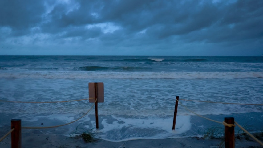
After a quiet couple of months, Atlantic hurricane season is now throwing an absolute monster toward the southeastern U.S. Hurricane Helene is churning rapidly north through the Gulf of Mexico on Thursday, gaining strength before it comes ashore in the evening in the Big Bend region of Florida. The messages out of the National Hurricane Center and NOAA have been among the most urgent I can remember.

The 5 AM update on Thursday screamed: “PREPARATIONS TO PROTECT LIFE AND PROPERTY SHOULD BE RUSHED TO COMPLETION.” Key messages included four uses of the word “catastrophic” and four of “deadly” or “life-threatening.” The National Weather Service in Tallahassee called potential storm surge of up to an astonishing 20 feet “unsurvivable.”

On Wednesday evening, NOAA sent out a special update to the media, calling it a “rare news release” outside the usual NOAA and NHC practices. They urged the media to focus not just on that coastal storm surge but on the threat of inland flooding; the speed and size of the storm are such that some of the worst impacts will likely happen a few hundred miles from the Gulf Coast, where as much as 18 inches of rain will fall and flash flooding risks are very high.

“The major flood risk includes the urban areas around Tallahassee, metro Atlanta and western North Carolina, including Asheville,” NOAA wrote. “Recent rainfall in these areas, especially the southern Appalachians, have left the grounds saturated and the river tributaries running high. Additional rainfall from Helene will exacerbate the existing flood risk.”

Helene will hit Florida by some point Thursday evening. If you or anyone you know is in its way, it is time to get ready.

 
Join the discussion...